
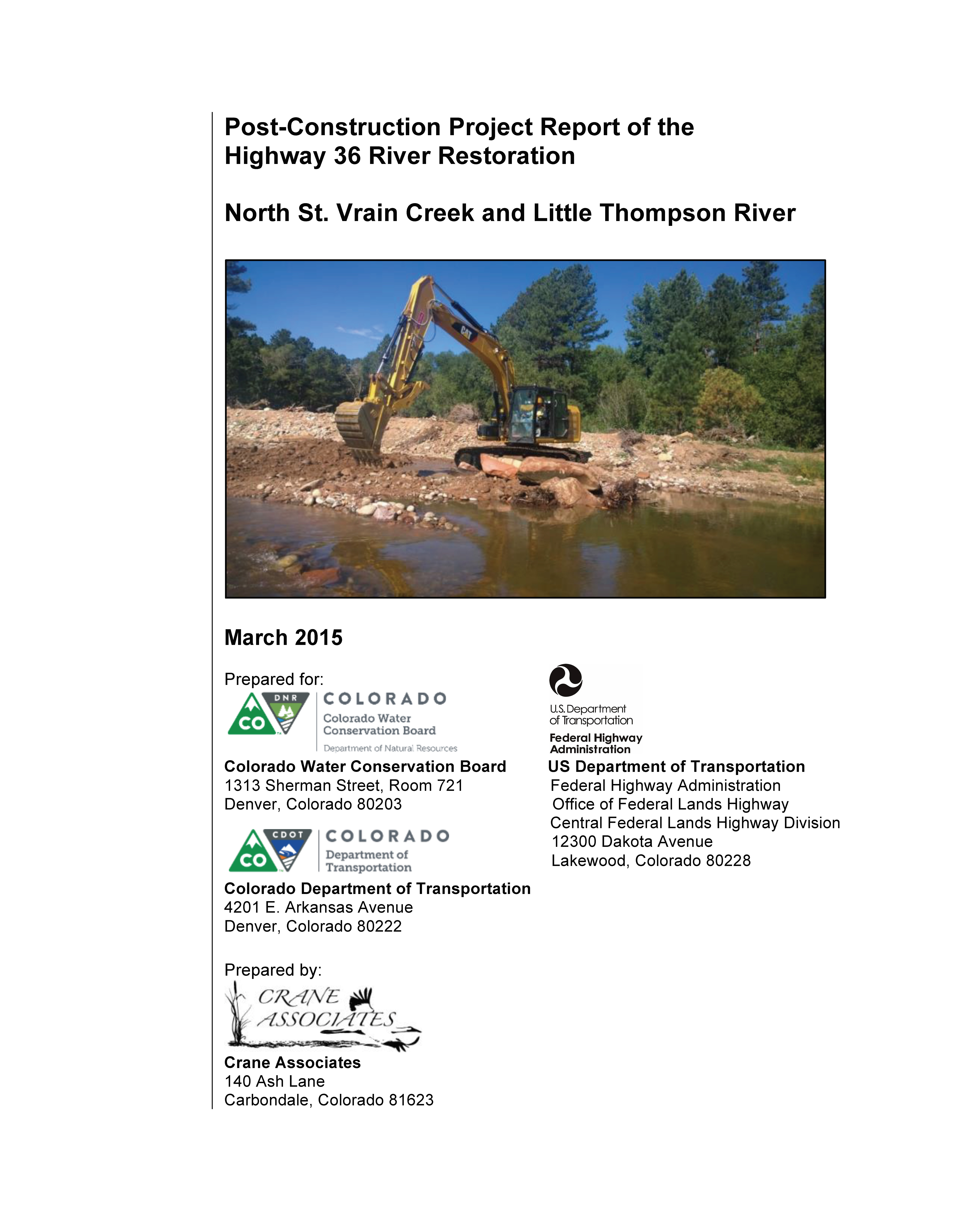
Project Description
NORTH ST. VRAIN CREEK AND
LITTLE THOMPSON RIVER RESTORATION
MULTI-OBJECTIVE
Roadway protection
and resiliency
Flood hazard reduction
Aquatic and riparian habitat enhancement
US Highway 36
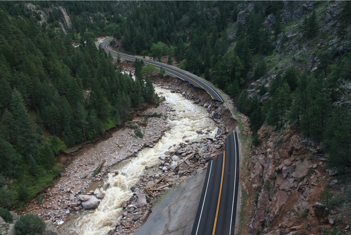
This project along US 36 addressed river function (sediment transport and water conveyance at high and low flows) and stabilizing the channel for the long-term protection of the highway. Additional goals included public access and construction of features friendly to recreation. Materials, equipment, volunteers, and expertise were leveraged from the highway reconstruction efforts in order to restore the river channel, saving an estimated $1.3 million.

The river channel reshaped following road construction.
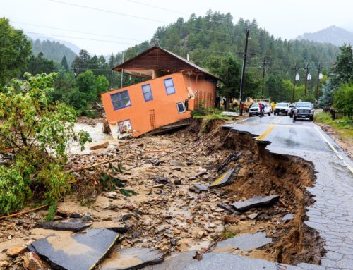
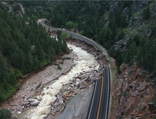
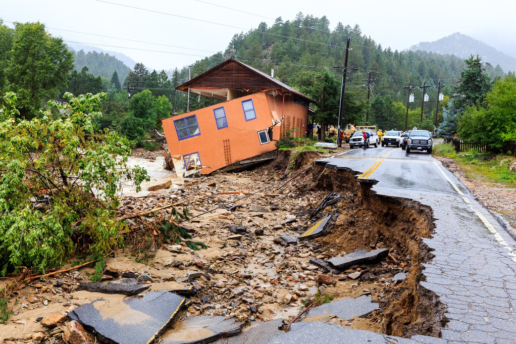
The September 2013 flood caused significant damage to the US Highway 36 (US 36) corridor. The Colorado Department of Transportation’s (CDOT) emergency and permanent road reconstruction activities were followed by a stream corridor restoration effort that focused on lands within and adjacent to the highway right-of-way at 17 locations on North Saint Vrain Creek upstream of the Town of Lyons and the Little Thompson River near Pinewood Springs.
Cost-effectiveness of collaboration between the highway reconstruction and river restoration projects was evaluated in this report by comparing the actual expenditures of the stream rehabilitation, including the construction, construction oversight, design, coordination, and permitting, to an engineer’s opinion of probable cost for a stand-alone river restoration project that would have produced the same on-the-ground product had it been contracted by an outside agency, a watershed coalition, or CDOT and private landowners without collaboration with the permanent road rebuild. The utilization of materials generated during the highway reconstruction, along with the provision of construction equipment made available under the highway budget, resulted in an 85 percent cost savings for the river restoration activities conducted on North St. Vrain Creek and the Little Thompson River.
River Channel Restoration
The primary intent of this stream rehabilitation project was to reconstruct a channel capable of efficient sediment transport, effective water conveyance at a range of high and low flows, and the establishment of relative lateral and vertical stability for the benefit of long-term protection of Highway 36. Additional goals included public access and construction of features friendly to recreation. These goals were accomplished through the creation of a multi-stage channel and increased in-channel habitat complexity via the strategic placement of boulders, rock structures, and large wood. In order to develop a comprehensive and holistic approach to the rehabilitation of the channel and its floodplain, adjacent riverfront landowners were approached and asked for permission to incorporate restoration treatments on their side of the river. The resulting 100 percent acceptance rate eliminated a patchwork of management actions and facilitated a coherent, consistent restoration project.

This river restoration project was designed and built around restoring river processes, not just river form. The features that were built are intended to encourage long-term system stability by providing a framework within which natural sediment movement and ecosystem processes can dominate. The river, and low-flow channel in particular, is expected to move and adjust; the river system is expected to recruit woody vegetation and woody debris; and the bankfull channel is expected to scour and form new deposits as it adjusts to varying flow and sediment loading cycles in the coming years and decades. Evidence of these adjustments and observations of change will deem this project a success, not a failure. A monitoring program to record and measure these changes is recommended. In order to maintain and capitalize on improvements made through this river restoration effort, important future activities to be conducted at the US 36 project sites include this long-term monitoring as well as active riparian revegetation.
The US 36 river restoration project had several constraints that influenced the recommended design, particularly the encroachment of the roadway embankment on the river channel corridor. Implementation of the river restoration project was influenced by an accelerated timeline, availability of construction equipment, and transport of needed construction materials. However, useful lessons were learned throughout the process that can benefit future flood recovery efforts and other restoration projects that involve a shared roadway/river corridor.

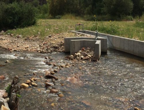
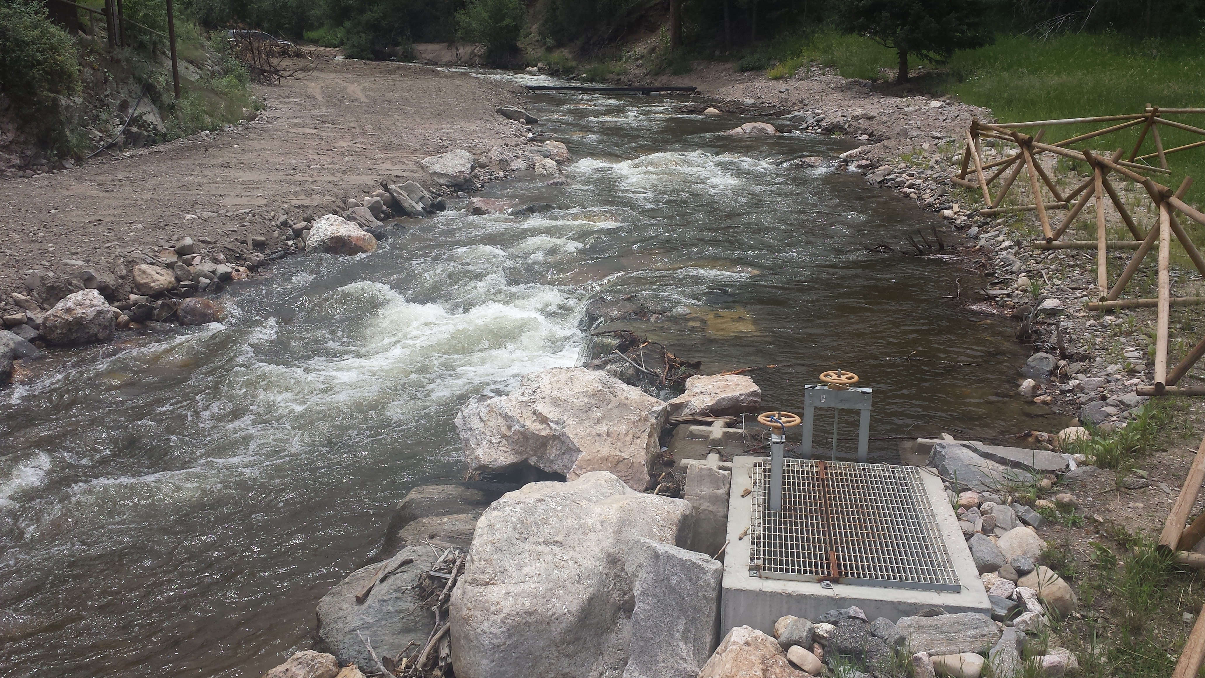
Floodplain benches balance the low flow channel while allowing high water to access the floodplain and dissipate energy.

Reshaping the Channel after Road Construction.

The raw river channel after road construction (click to enlarge image).
BEFORE
The North St. Vrain and Little Thompson River channels, squeezed by natural canyon walls and encroached on by US 36, underwent significant bed scour and lateral erosion during the September flood. A National Guard damage assessment team was deployed immediately after the rains stopped. Between mile post 7.7 and 18.6, the team identified 17 sites where US 36 had been significantly damaged. At each of these locations, the streams had reclaimed their historic corridor by undermining and overtaking the roadway embankment. The washouts caused large sections of roadway, including asphalt, road base, guardrail, and signing, to collapse into the river. The road material amassed in the river channel, along with uprooted trees, cars, river rock, and a collection of debris from flooded houses.2 These and other flood-mobilized materials were deposited in the channel and on the floodplain, leaving debris fields and scour zones.
The resulting post-flood streams were immediately re-channelized into their pre-flood alignment by the National Guard, CDOT contractors, and private contractors hired to provide temporary emergency access. Newly scoured bends and areas of lateral migration were filled during this process and the stream beds were left in a raw and unstable condition.
AFTER
The main purpose of these features was to enhance stream structure and function by encouraging the natural processes that reinforce river form and stability. Features were incorporated in order to dissipate energy, stabilize the raw and unconsolidated banks, and increase floodplain capacity in anticipation of future high-flow events while integrating aquatic habitat complexity.
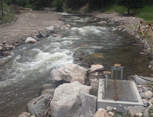
Low-flow channels were integrated to ensure connectivity of aquatic habitat during base-flow conditions. The low-flow channel is permitted and expected to migrate laterally within the existing high-flow channel.

The reshaped, consolidated channel (click to enlarge image).
Point bars and alternating bars were constructed at most sites to reduce the width-to-depth ratio of the low-flow channel and to encourage natural sediment transport processes though the reach. These features increase floodplain capacity while adding channel complexity, and were constructed mainly using native cobbles, large buried rocks, and large woody debris. Point bars are features on the inside of sweeping bends, and alternating bars are present on both sides of the river, alternating between left bank and right bank, providing low low channel sinuosity when the overall river valley is straight.
Floodplain benches were incorporated in order to maintain a bankfull channel while allowing water during higher flow conditions to access the floodplain and dissipate river energy. These benches exist within the bankfull width of the channel, at an intermediate elevation between the channel bottom and the topographic floodplain or terraces.
Large woody debris was utilized in several areas for a variety of purposes, including floodplain roughness, bank stabilization, energy dissipation, and habitat complexity. Root wads were installed facing upstream on the outside of meander bends in order to dissipate energy and create micro-habitats (Figure 5). Large wood was placed strategically at an upstream, downstream, or perpendicular angle to check the direction and speed of the creek’s flow. These features were anchored utilizing large blast rock as ballast.
Boulder clusters and habitat boulders were placed throughout the channel to create habitat for fish and other aquatic species. Secondary benefits include increased channel roughness to slow water velocities and reduce sheer stress on the channel bed and banks (including the roadway embankment). These boulders may also create recreational features.
Grade control and drop structures were built to set the elevation of the streambed in order to reduce the likelihood of severe scour, as well as to aid in the maintenance of riffle and pool bed features. The pools created by these structures provide cover for fish and other aquatic organisms. Water quality at drop structures is enhanced through aeration, and stream bank erosion is typically reduced as energy is dissipated in the vertical instead of horizontal direction.
Riffle-pool sequences were constructed throughout the project reach to provide a heterogeneous physical environment that can be used by a diversity of organisms. They provide a refuge from high velocity waters and extreme temperatures, and promote habitat complexity by offering diverse areas of cover, food, as well as spawning and rearing areas.
Backwater pools were created to increase aquatic and riparian habitat diversity and provide an area of shallow, slower-moving water for aquatic species, particularly fry and juvenile trout.
Project Team
Within the road design and reconstruction process, a unique opportunity was presented for the US 36 reconstruction project to partner with stream restoration experts to restore the stream channel in conjunction with and with benefit to the highway work. CDOT and their partners sought out the Colorado Water Conservation Board (CWCB) and their contractor Crane Associates (referred to collectively as the Stream Recovery Team) to help guide the river restoration efforts.
The partnership afforded an opportunity to utilize highway reconstruction resources to design and construct stream channel enhancements adjacent to highway repairs. The Stream Recovery Team leveraged materials, equipment, manpower, and expertise onsite to reconstruct North St. Vrain Creek and the Little Thompson River in the vicinity of the highway repair sites.
The US 36 river restoration project was a success, due in large part to the support and encouragement of the CDOT and CFL leadership, and despite the accelerated time frame and restricted equipment and material availability. As the project served as an excellent pilot project for testing process and partnerships, lessons learned throughout the process will be beneficial to future flood recovery efforts, and to other restoration projects that involve a shared roadway/river corridor.
Coordination with private landowners is critical to implementing a comprehensive and holistic project without the typical patchwork that frequently results from individual landowners working on their own. The US 36 project’s cooperation with private landowners to conduct system-wide river improvements on both banks and upstream and downstream of property boundaries was absolutely necessary for this type of project and was executed extremely well. All of the landowners were cooperative and allowed the restoration to take place almost seamlessly across ownership boundaries.
Leave A Comment
You must be logged in to post a comment.