
Project Description
COUNTY ROAD 43 (CR 43)
NORTH FORK OF THE BIG THOMPSON RIVER
MULTI-OBJECTIVE
Roadway protection
and resiliency
Flood hazard reduction
Aquatic and riparian habitat enhancement
County Road 43
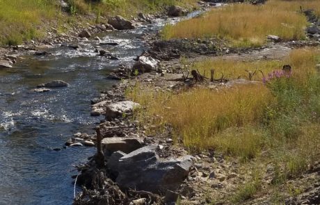
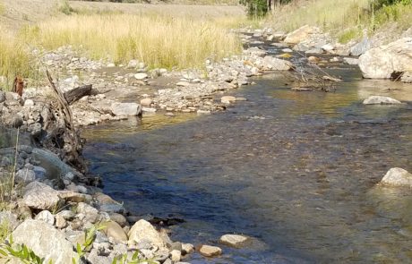
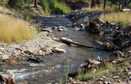
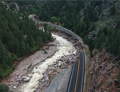
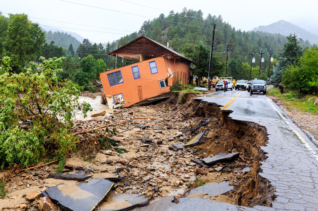
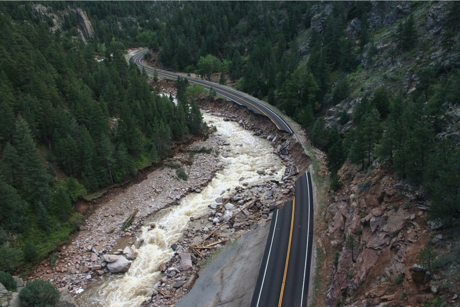
This cost-effective stream restoration project encompassed 17,500 linear feet of the North Fork of the Big Thompson River, reconstructing a channel capable of efficient sediment transport, effective water conveyance at high and low flows, and the establishment of relative stability for the benefit of long-term protection of Larimer County Road 43. The road and river alignments were flipped in eleven (11) locations to put the river on the outside bends of the valley to protect road infrastructure and build resilience into the overall project.
Road and River Nexus

The river channel and roadway were relocated for this project to protect the roadway, dissipate energy during high water events and improve resiliency.
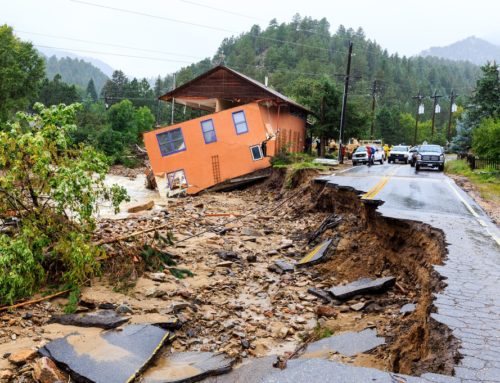
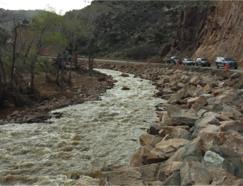
In September 2013, the Colorado Front Range experienced a large flood event that ravaged rivers, communities, and infrastructure, damaging and destroying large sections of highways, local roads, and public, residential, and commercial properties. Larimer County Road 43 (CR 43) was heavily damaged as a result of flooding and erosion. River restoration activities were conducted along most of the North Fork of the Big Thompson River where the river runs adjacent to the roadway.
Channel reconstruction activities were cost-effective due to collaboration between entities; materials, equipment, manpower, and expertise were leveraged from the highway reconstruction efforts in order to restore the river channel for the benefit of both the river and roadway.
Strategic placement of boulders, rock structures, and large wood were used in a comprehensive and holistic approach to the rehabilitation of the channel and its floodplain, in a coherent, consistent restoration project.
River Channel Restoration
This river restoration project was designed and built around restoring river processes, not just river form. The features that were built are intended to encourage long-term system stability by providing a framework within which natural sediment movement and ecosystem processes can dominate. The river, and low-flow channel in particular, is expected to move and adjust; the river system is expected to recruit woody vegetation and woody debris; and the bankfull channel is expected to scour and form new deposits as it adjusts to varying flow and sediment loading cycles in the coming years and decades.

Evidence of these adjustments and observations of change will deem this project a success, not a failure. A monitoring program to record and measure these changes is recommended. In order to maintain and capitalize on improvements made through this river restoration effort, important future activities to be conducted at the CR 43 project sites include this long-term monitoring as well as active riparian revegetation.
The ability to utilize materials from on site and equipment from the road construction project is crucial to developing a cost-effective and holistic project. Budget data from the CR 43 project was not available for analysis so only generalizations can be made, but cost savings have been shown to be substantial in previous projects. Using data from similar past projects it was estimated that this project as a stand-alone without the road construction would cost approximately $150/linear foot. Combining the road and river engineering, mobilization, materials, and equipment the project was constructed for approximately $50/linear foot; a saving of approximately $1.75 million.
The CR 43 river restoration project had several constraints that influenced the recommended design, particularly the encroachment of the roadway embankment on the river channel corridor. Implementation of the river restoration project was influenced by an accelerated timeline, availability of construction equipment, and transport of needed construction materials. However, useful lessons were learned throughout the process that can benefit future flood recovery efforts and other restoration projects that involve a shared roadway/river corridor.

Floodplain grading and boulder placement.

Experienced equipment operators reduce the time needed to build complicated features.
Riparian regeneration after one season of growth and root wad revetment with habitat wood
Testimonial
Four years ago (Jeff) did the stream restoration on our property, which lies just to the east of Glen Haven. (Jeff did) such an incredible job! The river flows perfectly at both high and low water levels… and the stream is teaming with fish. There is no question the stream is holding far more and healthier fish than before the flood – and we owe that to (Jeff). We appreciate all of the work and effort (focused) outside of the stream bed. We obviously don’t have the same old growth trees that we had prior to the flood… but all of the trees that we planted are looking great and thriving.Thanks Jeff, for everything that you did for the land (which we passionately care for). The work that you did really means a lot to us!

Riffle/pool sequencing is built into the project as part of natural channel design.
Design Features
Riffle-pool sequences were constructed throughout the project reach to provide a heterogeneous physical environment that can be used by a diversity of organisms. They provide a refuge from high velocity waters and extreme temperatures, and promote habitat complexity by offering diverse areas of cover, food, as well as spawning and rearing areas.
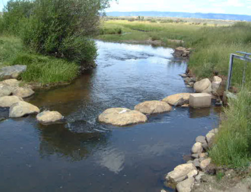
Low-flow channels were integrated to ensure connectivity of aquatic habitat during base-flow conditions.
Point bars and alternating bars were constructed at most sites to encourage natural sediment transport processes though the reach. These features were constructed mainly using native cobbles, large buried rocks, and large woody debris. Point bars are features on the inside of sweeping bends and alternating bars are present on both sides of the river, alternating between left bank and right bank, providing low-flow channel sinuosity when the overall river valley is straight.
Floodplain benches were incorporated to maintain a bankfull channel while allowing water during higher flow conditions to access the floodplain and dissipate river energy.
Large woody debris was utilized in several areas for a variety of purposes, including floodplain roughness, bank stabilization, energy dissipation, and habitat complexity. Root wads face upstream on the outside of meander bends to dissipate energy and create micro-habitats.
Boulder clusters and habitat boulders were placed throughout the channel to create habitat for fish and other aquatic species.

Large woody debris helps stabilize banks and creates habitat.

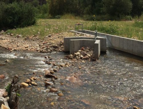
Low head boulder structures for fish-friendly irrigation diversions.
Grade control and drop structures were built to set the elevation of the streambed to reduce the likelihood of severe scour, as well as to aid in the maintenance of riffle and pool bed features. The pools created by these structures provide cover for fish and other aquatic organisms. Low head boulder structures were used for fish friendly irrigation diversions.
Backwater pools were created to increase aquatic and riparian habitat diversity and provide an area of shallow, slower-moving water for aquatic species, particularly fry and juvenile trout.
Project Team
Following the devastating flood of 2013, Larimer County applied to the Federal Highway Administration (FHWA) for assistance and was awarded funds and engineering assistance to rebuild County Road 43, which was washed away in several locations. The FHWA project manager quickly recognized that rebuilding the road in its current alignment would not be sustainable in future floods.
Crane Associates recommended plans for realigning the river channel in eleven locations to prevent erosion of the roadway during future floods. The County worked closely with private landowners and the US Forest Service to obtain necessary easements. Sponsors and partners collaborated to design a sustainable stream channel that enhanced the aquatic and riparian environment, resulting in a resilient nexus between the road and the river.
Partners & Funders
Private landowners
Wildland Restoration Volunteers
Larimer County
Federal Highway Administration (FHWA)
US Forest Service
Consultants
Crane Associates
Watershed Science and Design
Round River Design

RIVER-ROAD NEXUS COST EFFICIENCY
As a stand alone river restoration project, cost was estimated at $2.625 million at $150 per linear foot. Combining the river restoration and road reconstruction projects leveraged equipment and materials, saving approximately $1.75 million.
Note: Costs are approximated

Leave A Comment
You must be logged in to post a comment.